
Thank you for supporting this site ❤️
Make a donation
Make a donation
Gear up for your next adventure:
As an Amazon Associate, this site earns from qualifying purchases at no extra cost to you.
Zharkent topographic map
Click on the map to display elevation.
Thank you for supporting this site ❤️
Make a donation
Make a donation
Gear up for your next adventure:
As an Amazon Associate, this site earns from qualifying purchases at no extra cost to you.
About this map
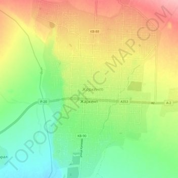
Name: Zharkent topographic map, elevation, terrain.
Location: Zharkent, Panfilov District, Jetisu Region, Kazakhstan (44.13453 79.97767 44.20389 80.04096)
Average elevation: 2,087 ft
Minimum elevation: 1,909 ft
Maximum elevation: 2,313 ft
Thank you for supporting this site ❤️
Make a donation
Make a donation
Gear up for your next adventure:
As an Amazon Associate, this site earns from qualifying purchases at no extra cost to you.