
Thank you for supporting this site ❤️
Make a donation
Make a donation
Gear up for your next adventure:
As an Amazon Associate, this site earns from qualifying purchases at no extra cost to you.
Pachacayo topographic map
Click on the map to display elevation.
Thank you for supporting this site ❤️
Make a donation
Make a donation
Gear up for your next adventure:
As an Amazon Associate, this site earns from qualifying purchases at no extra cost to you.
About this map
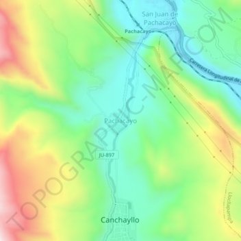
Name: Pachacayo topographic map, elevation, terrain.
Location: Pachacayo, Canchayllo, Jauja, Junín, Perú (-11.80540 -75.73765 -11.76540 -75.69765)
Average elevation: 12,211 ft
Minimum elevation: 11,509 ft
Maximum elevation: 13,409 ft
Thank you for supporting this site ❤️
Make a donation
Make a donation
Gear up for your next adventure:
As an Amazon Associate, this site earns from qualifying purchases at no extra cost to you.