
Make a donation
Gear up for your next adventure:
As an Amazon Associate, this site earns from qualifying purchases at no extra cost to you.
Gestel topographic map
Click on the map to display elevation.
Make a donation
Gear up for your next adventure:
As an Amazon Associate, this site earns from qualifying purchases at no extra cost to you.
About this map
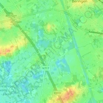
Name: Gestel topographic map, elevation, terrain.
Location: Gestel, Lummen, Hasselt, Limburg, Vlaanderen, 3560, België (51.00934 5.18933 51.04934 5.22933)
Average elevation: 102 ft
Minimum elevation: 59 ft
Maximum elevation: 174 ft
Make a donation
Gear up for your next adventure:
As an Amazon Associate, this site earns from qualifying purchases at no extra cost to you.
Other topographic maps
Click on a map to view its topography, its elevation and its terrain.
Meldert
België > Limburg > Hasselt > Lummen
Meldert ligt in het zuiden van het Kempens laagplateau, maar ten noorden van de plaats ligt een reeks getuigenheuvels die van het noordoosten in zuidwestelijke richting loopt en waarvan de hoogte tot 55 meter oploopt. Meldert ligt in de vallei van de Zwarte Beek, met in het noordoosten het natuurgebied Vallei…
Average elevation: 108 ft
Make a donation
Gear up for your next adventure:
As an Amazon Associate, this site earns from qualifying purchases at no extra cost to you.