
Thank you for supporting this site ❤️
Make a donation
Make a donation
Gear up for your next adventure:
As an Amazon Associate, this site earns from qualifying purchases at no extra cost to you.
Lumbatan topographic map
Click on the map to display elevation.
Thank you for supporting this site ❤️
Make a donation
Make a donation
Gear up for your next adventure:
As an Amazon Associate, this site earns from qualifying purchases at no extra cost to you.
About this map
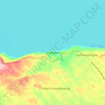
Name: Lumbatan topographic map, elevation, terrain.
Location: Lumbatan, Lanao del Sur, Bangsamoro, Philippines (7.74488 124.21522 7.82488 124.29522)
Average elevation: 2,461 ft
Minimum elevation: 2,254 ft
Maximum elevation: 2,989 ft
Thank you for supporting this site ❤️
Make a donation
Make a donation
Gear up for your next adventure:
As an Amazon Associate, this site earns from qualifying purchases at no extra cost to you.