
Thank you for supporting this site ❤️
Make a donation
Make a donation
Gear up for your next adventure:
As an Amazon Associate, this site earns from qualifying purchases at no extra cost to you.
Boussemghoun topographic map
Click on the map to display elevation.
Thank you for supporting this site ❤️
Make a donation
Make a donation
Gear up for your next adventure:
As an Amazon Associate, this site earns from qualifying purchases at no extra cost to you.
About this map
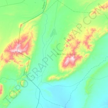
Name: Boussemghoun topographic map, elevation, terrain.
Location: Boussemghoun, Boussemghoun District, El Bayadh, 32014, Algeria (32.66267 -0.09473 32.95354 0.24808)
Average elevation: 3,583 ft
Minimum elevation: 2,753 ft
Maximum elevation: 6,496 ft
Thank you for supporting this site ❤️
Make a donation
Make a donation
Gear up for your next adventure:
As an Amazon Associate, this site earns from qualifying purchases at no extra cost to you.