
Thank you for supporting this site ❤️
Make a donation
Make a donation
Gear up for your next adventure:
As an Amazon Associate, this site earns from qualifying purchases at no extra cost to you.
Penamaluru topographic map
Click on the map to display elevation.
Thank you for supporting this site ❤️
Make a donation
Make a donation
Gear up for your next adventure:
As an Amazon Associate, this site earns from qualifying purchases at no extra cost to you.
About this map
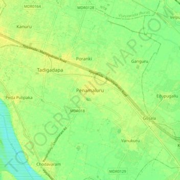
Name: Penamaluru topographic map, elevation, terrain.
Location: Penamaluru, Krishna, Andhra Pradesh, 521139, India (16.44309 80.69861 16.48309 80.73861)
Average elevation: 56 ft
Minimum elevation: 43 ft
Maximum elevation: 72 ft
Thank you for supporting this site ❤️
Make a donation
Make a donation
Gear up for your next adventure:
As an Amazon Associate, this site earns from qualifying purchases at no extra cost to you.