Geolocate

Manzanayocc topographic map

Click on the map to display elevation.

About this map

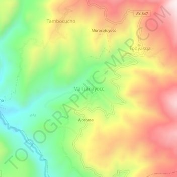
Name: Manzanayocc topographic map, elevation, terrain.

Location: Manzanayocc, Socos, Huamanga, Ayacucho, Perú (-13.37443 -74.30171 -13.33443 -74.26171)

Average elevation: 12,080 ft

Minimum elevation: 11,010 ft

Maximum elevation: 13,235 ft

Gear up for your next adventure:

🧺Microfiber Travel Towels - Compact and fast-drying towels for trail use
🎒Trail Energy Bars - High‑calorie bars for hiking energy
🧴Hand Sanitizer - Keep hands clean while hiking
🪑Ultralight Camp Chairs - Portable seating for resting after a long day of mapping
🔋Solar Power Banks - Keep your GPS and phone charged in remote wilderness areas

As an Amazon Associate, this site earns from qualifying purchases at no extra cost to you.