Geolocate

Much Hadham topographic map

Click on the map to display elevation.

About this map

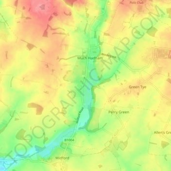
Name: Much Hadham topographic map, elevation, terrain.

Location: Much Hadham, East Hertfordshire, Hertfordshire, England, United Kingdom (51.81952 0.03268 51.87367 0.11686)

Average elevation: 262 ft

Minimum elevation: 121 ft

Maximum elevation: 381 ft

Other topographic maps

Click on a map to view its topography, its elevation and its terrain.

Gear up for your next adventure:

🔦LED Headlamp - Bright and durable LED headlamp for night navigation
🛶Inflatable Kayak - Portable kayak for rivers, lakes, and expeditions
🔭Telescopic Hiking Pole - Adjustable pole for hiking stability
🪵Folding Camp Saw - Compact saw for wood and campsite work
📱Heavy-Duty Phone Cases - Drop-proof and waterproof protection for outdoor navigation

As an Amazon Associate, this site earns from qualifying purchases at no extra cost to you.