
Jincheng topographic map
Interactive map
Click on the map to display elevation.
About this map
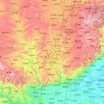
Name: Jincheng topographic map, elevation, terrain.
Location: Jincheng, Shanxi, Chine (35.18904 111.93531 36.06642 113.61923)
Average elevation: 2,697 ft
Minimum elevation: 249 ft
Maximum elevation: 6,476 ft
Other topographic maps
Click on a map to view its topography, its elevation and its terrain.