Geolocate

Achanizo topographic map

Click on the map to display elevation.

About this map

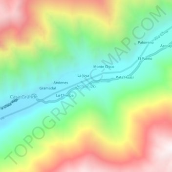
Name: Achanizo topographic map, elevation, terrain.

Location: Achanizo, Chaparra, Caravelí, Arequipa, Perú (-15.82506 -73.98663 -15.78506 -73.94663)

Average elevation: 3,570 ft

Minimum elevation: 1,696 ft

Maximum elevation: 6,319 ft

Gear up for your next adventure:

🧭Outdoor Navigation Book - Learn advanced navigation skills
👟Trail Running Shoes - Lightweight shoes for trail runners
🕶️Glacier Sunglasses - Side shields to protect eyes from high-altitude snow glare
📶Satellite Messenger - Communication device off‑grid
🔭Stargazing Telescopes - Perfect for camping in low-light pollution areas shown on maps

As an Amazon Associate, this site earns from qualifying purchases at no extra cost to you.