
Thank you for supporting this site ❤️
Make a donation
Make a donation
Gear up for your next adventure:
As an Amazon Associate, this site earns from qualifying purchases at no extra cost to you.
Lauropoli topographic map
Click on the map to display elevation.
Thank you for supporting this site ❤️
Make a donation
Make a donation
Gear up for your next adventure:
As an Amazon Associate, this site earns from qualifying purchases at no extra cost to you.
About this map
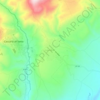
Name: Lauropoli topographic map, elevation, terrain.
Location: Lauropoli, Cassano all'Ionio, Cosenza, Calabria, 87011, Italy (39.75955 16.31760 39.79955 16.35760)
Average elevation: 689 ft
Minimum elevation: 180 ft
Maximum elevation: 1,634 ft
Thank you for supporting this site ❤️
Make a donation
Make a donation
Gear up for your next adventure:
As an Amazon Associate, this site earns from qualifying purchases at no extra cost to you.