
Thank you for supporting this site ❤️
Make a donation
Make a donation
Gear up for your next adventure:
As an Amazon Associate, this site earns from qualifying purchases at no extra cost to you.
Candelillas topographic map
Click on the map to display elevation.
Thank you for supporting this site ❤️
Make a donation
Make a donation
Gear up for your next adventure:
As an Amazon Associate, this site earns from qualifying purchases at no extra cost to you.
About this map
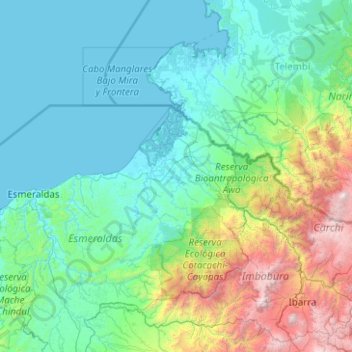
Name: Candelillas topographic map, elevation, terrain.
Location: Candelillas, Concepción, San Lorenzo, Esmeraldas, Ecuador (0.06917 -79.84250 2.06917 -77.84250)
Average elevation: 2,142 ft
Minimum elevation: -3 ft
Maximum elevation: 15,551 ft
Thank you for supporting this site ❤️
Make a donation
Make a donation
Gear up for your next adventure:
As an Amazon Associate, this site earns from qualifying purchases at no extra cost to you.