Geolocate

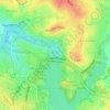
Spence topographic map

Click on the map to display elevation.

About this map

Name: Spence topographic map, elevation, terrain.

Location: Spence, District of Belconnen, Australian Capital Territory, Australia (-35.20775 149.05732 -35.18995 149.07368)

Average elevation: 2,047 ft

Minimum elevation: 1,893 ft

Maximum elevation: 2,313 ft

Other topographic maps

Click on a map to view its topography, its elevation and its terrain.
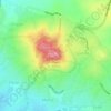
Mount Rogers

Australia > District of Belconnen

Mount Rogers is a large hill, with an elevation of 704 metres (2,310 ft), located in the northern suburbs of Canberra, within the Australian Capital Territory, Australia. There is a park called the Mount Rogers Reserve at the crest of the hill, and a trig point at the summit.

Average elevation: 2,034 ft
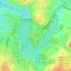
Diddams Close Park

Australia > District of Belconnen

Average elevation: 1,932 ft

Ginninderra Creek

Australia > District of Belconnen

Average elevation: 1,929 ft

Gossan Hill

Australia > District of Belconnen

Average elevation: 2,041 ft

Gear up for your next adventure:

🎁Geography Themed Gifts - Unique gift ideas for map lovers and geography enthusiasts
🔋Solar Power Banks - Keep your GPS and phone charged in remote wilderness areas
🧥Waterproof Jacket for Hiking - Breathable and rugged rain jacket for outdoor excursions
⛺Backpacking Tents - Weight-optimized shelters for multi-day topographic surveys
🎒Gear Packing Cubes - Organize your backpack efficiently

As an Amazon Associate, this site earns from qualifying purchases at no extra cost to you.