Geolocate

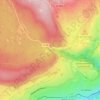
Els Colls topographic map

Click on the map to display elevation.

About this map

Name: Els Colls topographic map, elevation, terrain.

Location: Els Colls, La Llagonne, Prades, Pyrénées-Orientales, Occitanie, France métropolitaine, 66210, France (42.51041 2.10807 42.55041 2.14807)

Average elevation: 5,696 ft

Minimum elevation: 4,744 ft

Maximum elevation: 6,667 ft

Other topographic maps

Click on a map to view its topography, its elevation and its terrain.
Gear up for your next adventure:

📖Nature Tracking Books - Learn to track wildlife and terrain
📱Heavy-Duty Phone Cases - Drop-proof and waterproof protection for outdoor navigation
📶Satellite Messenger - Communication device off‑grid
🥤Water Filter Bottle - All‑in‑one filter bottle for safe hydration
🥇GPS Hiking Watch - Multi‑sport GPS watch with navigation and trail tracking

As an Amazon Associate, this site earns from qualifying purchases at no extra cost to you.