
Thank you for supporting this site ❤️
Make a donation
Make a donation
Gear up for your next adventure:
As an Amazon Associate, this site earns from qualifying purchases at no extra cost to you.
Longhi topographic map
Click on the map to display elevation.
Thank you for supporting this site ❤️
Make a donation
Make a donation
Gear up for your next adventure:
As an Amazon Associate, this site earns from qualifying purchases at no extra cost to you.
About this map
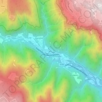
Name: Longhi topographic map, elevation, terrain.
Location: Longhi, Pedemonte, Vicenza, Veneto, 36040, Italia (45.88876 11.28922 45.92876 11.32922)
Average elevation: 2,943 ft
Minimum elevation: 1,339 ft
Maximum elevation: 5,069 ft
Thank you for supporting this site ❤️
Make a donation
Make a donation
Gear up for your next adventure:
As an Amazon Associate, this site earns from qualifying purchases at no extra cost to you.