
Make a donation
Gear up for your next adventure:
As an Amazon Associate, this site earns from qualifying purchases at no extra cost to you.
Cerro Sarisariñama topographic map
Click on the map to display elevation.
Make a donation
Gear up for your next adventure:
As an Amazon Associate, this site earns from qualifying purchases at no extra cost to you.
Cerro Sarisariñama
Cerro Sarisariñama is a tepui, a flat-topped mountain in Jaua-Sarisariñama National Park at the far south-west of Bolívar State, Venezuela, near the border with Brazil. Its altitude range is between 300 m (980 ft) and 2,350 m (7,710 ft). The name of the mountain originates from the tale of the local Ye'kuana people about an evil spirit living in caves up in the mountain and devouring human flesh with a sound "Sari... sari...".
Make a donation
Gear up for your next adventure:
As an Amazon Associate, this site earns from qualifying purchases at no extra cost to you.
About this map
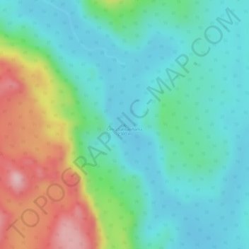
Name: Cerro Sarisariñama topographic map, elevation, terrain.
Average elevation: 4,255 ft
Minimum elevation: 4,032 ft
Maximum elevation: 4,757 ft
Make a donation
Gear up for your next adventure:
As an Amazon Associate, this site earns from qualifying purchases at no extra cost to you.