Geolocate

Basud topographic map

Click on the map to display elevation.

About this map

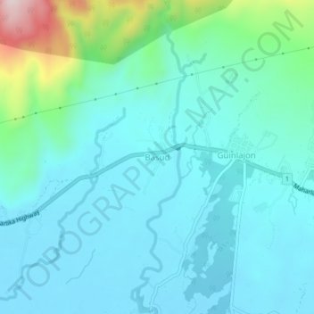
Name: Basud topographic map, elevation, terrain.

Location: Basud, Sorsogon, Bicol Region, 4700, Philippines (12.96613 123.93589 13.00613 123.97589)

Average elevation: 243 ft

Minimum elevation: 3 ft

Maximum elevation: 1,394 ft

Other topographic maps

Click on a map to view its topography, its elevation and its terrain.

Bulusan Volcano Natural Park

Philippines > Sorsogon

Average elevation: 1,414 ft

Castilla

Philippines > Sorsogon

Average elevation: 272 ft

Pilar

Philippines > Sorsogon

Average elevation: 79 ft

Donsol

Philippines > Sorsogon

Average elevation: 66 ft

Bulusan Lake

Philippines > Sorsogon > San Roque

Lake Bulusan is a lake on Luzon Island in the Philippines. It lies at the heart of Bulusan Volcano National Park which covers a land area of 3,672 hectares (9,070 acres). It has an elevation of 360 metres (1,180 ft) and is located on the southeast flank of Mount Bulusan, an active volcano.

Average elevation: 1,253 ft

Calintaan Island

Philippines > Sorsogon > Calintaan

Average elevation: 20 ft

Sorsogon River

Philippines > Sorsogon > Sorsogon City

Average elevation: 62 ft

J.Gerona (Biton)

Philippines > Sorsogon

Average elevation: 39 ft

Castilla

Philippines > Sorsogon

Average elevation: 272 ft

Donsol

Philippines > Sorsogon

Average elevation: 66 ft

Donsol

Philippines > Sorsogon

Average elevation: 66 ft

Gear up for your next adventure:

🔦Compact Flashlight - Reliable flashlight for emergencies
📚Navigation Handbooks - Master the art of reading topographic maps and using a compass
Camping Coffee Makers - Enjoy premium coffee at the summit or campsite
🔥Camping Stove - Portable stove for camping and backcountry cooking
💧Water Filtration Bottles - Safely drink from streams and lakes while exploring

As an Amazon Associate, this site earns from qualifying purchases at no extra cost to you.