Geolocate

Foligno topographic map

Click on the map to display elevation.

About this map

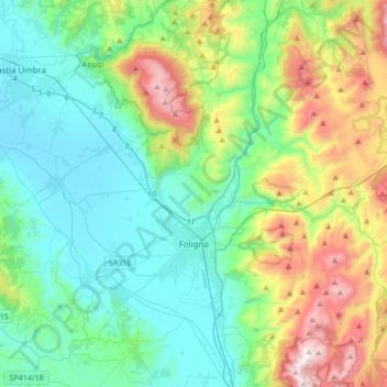
Name: Foligno topographic map, elevation, terrain.

Location: Foligno, Perugia, Umbria, 06034, Italy (42.90405 12.61160 43.07211 12.95144)

Average elevation: 1,657 ft

Minimum elevation: 600 ft

Maximum elevation: 4,636 ft

Gear up for your next adventure:

🪶Multi‑Purpose Knife - Useful blade for camp and trail
🦶Hiking Gaiters - Keep debris and water out of your boots
Solar GPS Watches - Advanced multisport watches with built-in topographic maps
😴Insulated Sleeping Pads - Compact and warm pads for high-elevation camping
🎒Trail Energy Bars - High‑calorie bars for hiking energy

As an Amazon Associate, this site earns from qualifying purchases at no extra cost to you.