Geolocate

Agliè topographic map

Click on the map to display elevation.

About this map

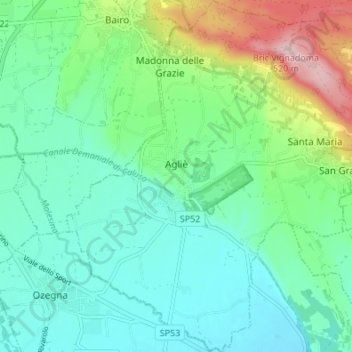
Name: Agliè topographic map, elevation, terrain.

Location: Agliè, Torino, Piemont, 10011, Italy (45.34149 7.74574 45.38920 7.80301)

Average elevation: 1,112 ft

Minimum elevation: 909 ft

Maximum elevation: 1,696 ft

Gear up for your next adventure:

GPS Sports Watch - GPS watch for running, hiking and training
🧼Biodegradable Camping Soap - Eco‑friendly soap for outdoor hygiene
🏫Relief Map Kits - Hands-on tools for teaching landforms and elevation
📚Navigation Handbooks - Master the art of reading topographic maps and using a compass
🧭GPS Watch Accessories - Bands and chargers for GPS watches

As an Amazon Associate, this site earns from qualifying purchases at no extra cost to you.