
Thank you for supporting this site ❤️
Make a donation
Make a donation
Gear up for your next adventure:
As an Amazon Associate, this site earns from qualifying purchases at no extra cost to you.
Garhgaon topographic map
Click on the map to display elevation.
Thank you for supporting this site ❤️
Make a donation
Make a donation
Gear up for your next adventure:
As an Amazon Associate, this site earns from qualifying purchases at no extra cost to you.
About this map
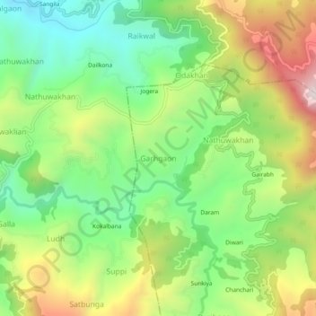
Name: Garhgaon topographic map, elevation, terrain.
Location: Garhgaon, Dhari, Nainital, Uttarakhand, 263138, India (29.44716 79.60131 29.48716 79.64131)
Average elevation: 5,951 ft
Minimum elevation: 4,882 ft
Maximum elevation: 7,569 ft
Thank you for supporting this site ❤️
Make a donation
Make a donation
Gear up for your next adventure:
As an Amazon Associate, this site earns from qualifying purchases at no extra cost to you.