
Thank you for supporting this site ❤️
Make a donation
Make a donation
Gear up for your next adventure:
As an Amazon Associate, this site earns from qualifying purchases at no extra cost to you.
Poopo topographic map
Click on the map to display elevation.
Thank you for supporting this site ❤️
Make a donation
Make a donation
Gear up for your next adventure:
As an Amazon Associate, this site earns from qualifying purchases at no extra cost to you.
About this map
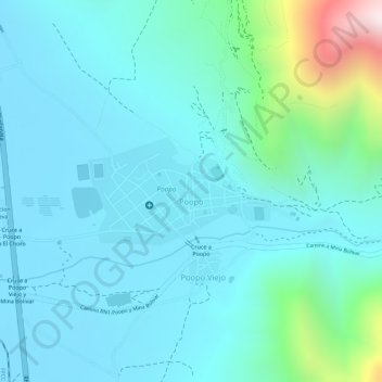
Name: Poopo topographic map, elevation, terrain.
Location: Poopo, Provincia Poopó, Oruro, Bolivia (-18.38273 -66.97236 -18.37660 -66.95996)
Average elevation: 12,572 ft
Minimum elevation: 12,192 ft
Maximum elevation: 14,432 ft
Thank you for supporting this site ❤️
Make a donation
Make a donation
Gear up for your next adventure:
As an Amazon Associate, this site earns from qualifying purchases at no extra cost to you.