Geolocate

Toledo topographic map

Click on the map to display elevation.

About this map

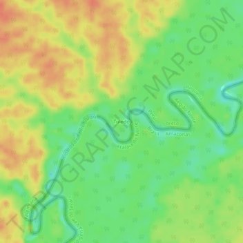
Name: Toledo topographic map, elevation, terrain.

Location: Toledo, Yaquerana, Requena, Loreto, Peru (-5.88837 -73.16598 -5.84837 -73.12598)

Average elevation: 413 ft

Minimum elevation: 338 ft

Maximum elevation: 482 ft

Gear up for your next adventure:

🌡️Handheld Weather Meters - Measure wind, temp, and pressure for safe mountain travel
🩹Survival Bandages - High‑quality bandages for emergencies
🥾Men's Hiking Boots - Durable, waterproof footwear for rugged terrain and steep inclines
🧷Carabiner Set - Durable clips for gear attachment
📦Gear Storage Bags - Organize and protect outdoor equipment

As an Amazon Associate, this site earns from qualifying purchases at no extra cost to you.