Geolocate

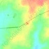
Trinidad topographic map

Click on the map to display elevation.

About this map

Name: Trinidad topographic map, elevation, terrain.

Location: Trinidad, Itapúa, Región Oriental, Paraguay (-27.21993 -55.84071 -27.07008 -55.62079)

Average elevation: 515 ft

Minimum elevation: 259 ft

Maximum elevation: 932 ft

Other topographic maps

Click on a map to view its topography, its elevation and its terrain.
Coronel Bogado

Paraguay > Itapúa

Average elevation: 344 ft

San Martín

Paraguay > Itapúa > Carmen del Paraná

Average elevation: 407 ft

Gear up for your next adventure:

🪶LED Camping Lantern - Bright lantern for camp lighting
🪑Ultralight Camp Chairs - Portable seating for resting after a long day of mapping
🛠️Backpacking Tool Kit - Essential toolkit for outdoor repairs
🥩Freeze-Dried Meals - Nutritious and lightweight food for remote expeditions
🥄Camping Utensil Set - Lightweight utensils for outdoor meals

As an Amazon Associate, this site earns from qualifying purchases at no extra cost to you.