Geolocate

Tigbawan topographic map

Click on the map to display elevation.

About this map

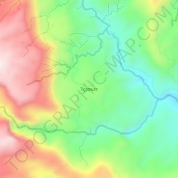
Name: Tigbawan topographic map, elevation, terrain.

Location: Tigbawan, Baganga, Davao Oriental, Davao Region, Philippines (7.53884 126.44081 7.57884 126.48081)

Average elevation: 1,102 ft

Minimum elevation: 217 ft

Maximum elevation: 2,290 ft

Gear up for your next adventure:

❄️Traction Cleats - Prevent slips on icy trails during winter hikes
🎒Trail Energy Bars - High‑calorie bars for hiking energy
📱Heavy-Duty Phone Cases - Drop-proof and waterproof protection for outdoor navigation
🏕️Tent Footprint - Protect your tent base from wear
🦺Reflective Outdoor Gear - Safety gear for low‑light conditions

As an Amazon Associate, this site earns from qualifying purchases at no extra cost to you.