
马渡关镇 topographic map
Interactive map
Click on the map to display elevation.
About this map
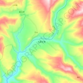
Name: 马渡关镇 topographic map, elevation, terrain.
Location: 马渡关镇, 宣汉县, 达州市, 四川省, 中国 (31.55705 107.43624 31.63705 107.51624)
Average elevation: 1,952 ft
Minimum elevation: 1,070 ft
Maximum elevation: 3,120 ft
Other topographic maps
Click on a map to view its topography, its elevation and its terrain.