
Thank you for supporting this site ❤️
Make a donation
Make a donation
Gear up for your next adventure:
As an Amazon Associate, this site earns from qualifying purchases at no extra cost to you.
Lansival topographic map
Click on the map to display elevation.
Thank you for supporting this site ❤️
Make a donation
Make a donation
Gear up for your next adventure:
As an Amazon Associate, this site earns from qualifying purchases at no extra cost to you.
About this map
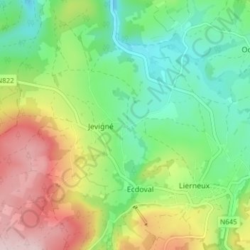
Name: Lansival topographic map, elevation, terrain.
Location: Lansival, Lierneux, Verviers, Liège, Wallonie, 4990, Belgique (50.27546 5.75481 50.31546 5.79481)
Average elevation: 1,398 ft
Minimum elevation: 1,056 ft
Maximum elevation: 1,955 ft
Thank you for supporting this site ❤️
Make a donation
Make a donation
Gear up for your next adventure:
As an Amazon Associate, this site earns from qualifying purchases at no extra cost to you.