Geolocate

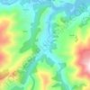
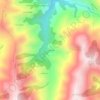
Sorriba topographic map

Click on the map to display elevation.

About this map

Name: Sorriba topographic map, elevation, terrain.

Location: Sorriba, Tineo, Asturias, España (43.25398 -6.47027 43.30834 -6.41332)

Average elevation: 1,568 ft

Minimum elevation: 709 ft

Maximum elevation: 3,028 ft

Other topographic maps

Click on a map to view its topography, its elevation and its terrain.

El Biar

España > Asturias > Tineo > El Peligro

Average elevation: 2,021 ft

La Pereda

España > Asturias > Tineo

Average elevation: 2,156 ft

Tuña

España > Asturias > Tineo

Average elevation: 1,453 ft

Miño

España > Asturias > Tineo

Average elevation: 1,217 ft

Río Navelgas

España > Asturias > Tineo

Average elevation: 1,654 ft

Espinaredo

España > Asturias > Tineo

Average elevation: 2,165 ft

Navelgas

España > Asturias > Tineo

Average elevation: 1,266 ft

Moure

España > Asturias > Tineo

Average elevation: 1,706 ft

Genestaza

España > Asturias > Tineo

Average elevation: 3,222 ft

Gear up for your next adventure:

🔥Plasma Lighters - Windproof lighters that work in any weather condition
🧤Hiking Gloves - Protective gloves for rugged trails
📦Dry Bags Set - Waterproof storage for electronics and clothes
☕Camping Coffee Makers - Enjoy premium coffee at the summit or campsite
🥘Titanium Cookware - Durable, featherlight pots and pans for backpacking

As an Amazon Associate, this site earns from qualifying purchases at no extra cost to you.