Geolocate

Kayhakat topographic map

Click on the map to display elevation.

About this map

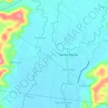
Name: Kayhakat topographic map, elevation, terrain.

Location: Kayhakat, Santa Maria, Laguna, Calabarzon, 4022, Philippines (14.45027 121.39758 14.49027 121.43758)

Average elevation: 89 ft

Minimum elevation: 13 ft

Maximum elevation: 509 ft

Gear up for your next adventure:

🪶Thermal Camp Blanket - Extra warmth for cold nights
🚁Photography Drones - Capture stunning aerial views of landforms and topography
🎒Hydration Pack - Hands‑free water reservoir for long hikes
🪶Paracord Bracelet - Survival bracelet with built‑in tools
Backpacking Tent - Lightweight and durable tent for multi‑day hikes

As an Amazon Associate, this site earns from qualifying purchases at no extra cost to you.