Geolocate

Durca topographic map

Click on the map to display elevation.

About this map

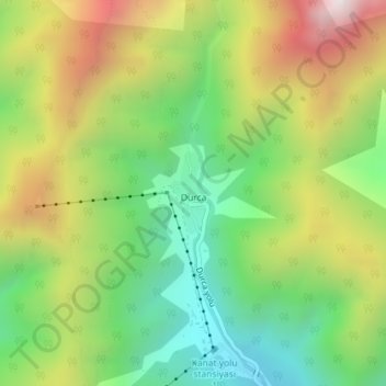
Name: Durca topographic map, elevation, terrain.

Location: Durca, Qabala District, Sheki-Zaqatala, Azerbaijan (41.04136 47.88333 41.04710 47.88657)

Average elevation: 5,413 ft

Minimum elevation: 3,917 ft

Maximum elevation: 7,500 ft

Other topographic maps

Click on a map to view its topography, its elevation and its terrain.

Shaki

Azerbaijan > Sheki-Zaqatala

Average elevation: 2,172 ft

Sheki-Zaqatala

Azerbaijan > Sheki-Zaqatala

Average elevation: 3,691 ft

Qakh District

Azerbaijan > Sheki-Zaqatala

Average elevation: 1,939 ft

Gear up for your next adventure:

📡Handheld GPS Device - Reliable handheld GPS for outdoor navigation
🦶Carbon Trekking Poles - Reduce knee impact on steep descents with ultra-light poles
📶Satellite Messenger - Communication device off‑grid
🎒Gear Packing Cubes - Organize your backpack efficiently
🌄Hiking Binoculars - Compact binoculars for scenic views and trail spotting

As an Amazon Associate, this site earns from qualifying purchases at no extra cost to you.