
Al-Manzala topographic map
Interactive map
Click on the map to display elevation.
About this map
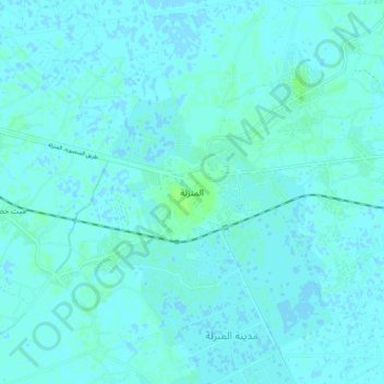
Name: Al-Manzala topographic map, elevation, terrain.
Location: Al-Manzala, Ad Dakahliya, 35642, Egypt (31.11940 31.89645 31.19940 31.97645)
Average elevation: 7 ft
Minimum elevation: -7 ft
Maximum elevation: 26 ft
Other topographic maps
Click on a map to view its topography, its elevation and its terrain.