Egypt topographic maps
Click on a map to view its topography, its elevation and its terrain.













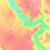
Abu Minqar
Geologically, the area forms part of the Dakhla—Abu Minqar plateau in a shallow depression between the Kharga and Dakhla depressions, with an elevation typically between 400 and 500 metres above sea level. The Abu Minqar Depression is often considered to be the extreme western subdivision of the Dakhla…
Average elevation: 469 ft











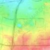
Qattara Depression
The Qattara Depression contains the second lowest point in Africa at an elevation of 133 metres (436 ft) below sea level, the lowest point being Lake Assal in Djibouti. The depression covers about 19,605 square kilometres (7,570 sq mi), a size comparable with Lake Ontario or twice as large as Lebanon. Due to…
Average elevation: -246 ft




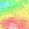
Suez Canal
Despite the construction challenges that could have been the result of the alleged difference in sea levels, the idea of finding a shorter route to the east remained alive. In 1830, General Francis Chesney submitted a report to the British government that stated that there was no difference in elevation and…
Average elevation: 348 ft
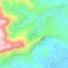
Al Azhar Park
In 1984, Aga Khan IV was visiting Cairo on a conference. From his hotel balcony; Al-Darassa hill (Arabic: هضبة الدراسة) was visible: mounts of wreckage and ruins amassed during 500 years. He decided to intervene and offer that medieval area via the Historic Cities Support Programme the…
Average elevation: 174 ft



Aswan Low Dam (Khazzan Aswan)
The Aswan Low Dam or Old Aswan Dam is a gravity masonry buttress dam on the Nile River in Aswan, Egypt. The dam was built by the British at the former first cataract of the Nile, and is located about 1000 km up-river and 690 km (direct distance) south-southeast of Cairo. When initially constructed between 1899…
Average elevation: 371 ft