
Thank you for supporting this site ❤️
Make a donation
Make a donation
Gear up for your next adventure:
As an Amazon Associate, this site earns from qualifying purchases at no extra cost to you.
Segnas topographic map
Click on the map to display elevation.
Thank you for supporting this site ❤️
Make a donation
Make a donation
Gear up for your next adventure:
As an Amazon Associate, this site earns from qualifying purchases at no extra cost to you.
About this map
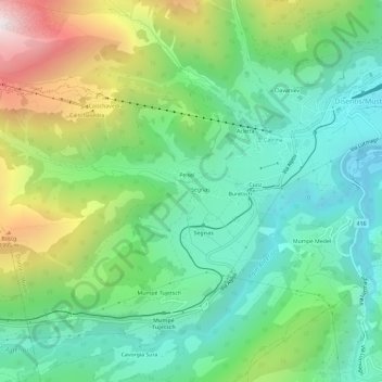
Name: Segnas topographic map, elevation, terrain.
Location: Segnas, Disentis/Mustér, Surselva, Grisons, 7186, Suisse (46.67471 8.80892 46.71471 8.84892)
Average elevation: 4,872 ft
Minimum elevation: 3,432 ft
Maximum elevation: 7,956 ft
Thank you for supporting this site ❤️
Make a donation
Make a donation
Gear up for your next adventure:
As an Amazon Associate, this site earns from qualifying purchases at no extra cost to you.
Other topographic maps
Click on a map to view its topography, its elevation and its terrain.
Bebauung Peisel
Suisse > Grisons > Surselva > Disentis/Mustér > Segnas > Peisel
Average elevation: 4,839 ft