Geolocate

Sviatoshynskyi district topographic map

Click on the map to display elevation.

About this map

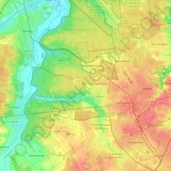
Name: Sviatoshynskyi district topographic map, elevation, terrain.

Location: Sviatoshynskyi district, Kyiv, Ukraine (50.39804 30.23615 50.54768 30.42770)

Average elevation: 499 ft

Minimum elevation: 341 ft

Maximum elevation: 689 ft

Other topographic maps

Click on a map to view its topography, its elevation and its terrain.

Пронівщина

Ukraine > Kyiv

Average elevation: 571 ft

Gear up for your next adventure:

🦟Ultrasonic Repellers - Create a bug-free zone at your camp or rest stop
🚗GPS Dash Cams - Record your scenic drives through mountain passes and canyons
🎒Trekking Poles - Sturdy poles for balance and stability on rough terrain
🛠️Backpacking Tool Kit - Essential toolkit for outdoor repairs
🔪Outdoor Multitools - Essential survival tools for gear repair and field use

As an Amazon Associate, this site earns from qualifying purchases at no extra cost to you.