Geolocate

Sunset topographic map

Click on the map to display elevation.

About this map

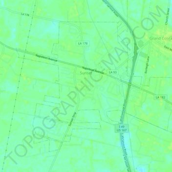
Name: Sunset topographic map, elevation, terrain.

Location: Sunset, St. Landry Parish, Louisiana, 70584, United States (30.39165 -92.08877 30.42427 -92.03914)

Average elevation: 52 ft

Minimum elevation: 30 ft

Maximum elevation: 66 ft

St. Landry Parish trails, hiking, mountain biking, running and outdoor activities

Other topographic maps

Click on a map to view its topography, its elevation and its terrain.

Bayou Jack

United States > Louisiana > St. Landry Parish

Average elevation: 39 ft

Gear up for your next adventure:

🛰️Satellite Messengers - Emergency SOS and two-way messaging for off-grid adventures
🧥Men's Rain Shells - Premium waterproof and breathable jackets for mountain weather
🌎3D Topographic Globes - Raised relief globes for a tactile understanding of geography
🏕️Tent Footprint - Protect your tent base from wear
🏫Relief Map Kits - Hands-on tools for teaching landforms and elevation

As an Amazon Associate, this site earns from qualifying purchases at no extra cost to you.