
中川镇 topographic map
Interactive map
Click on the map to display elevation.
About this map
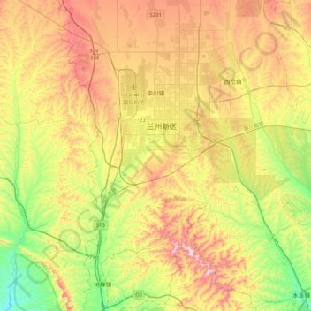
Name: 中川镇 topographic map, elevation, terrain.
Location: 中川镇, 兰州新区, 永登县, 兰州市, 甘肃省, 中国 (36.28722 103.53432 36.60867 103.73569)
Average elevation: 6,289 ft
Minimum elevation: 5,400 ft
Maximum elevation: 7,411 ft
Other topographic maps
Click on a map to view its topography, its elevation and its terrain.