
Mutimbuzi topographic map
Interactive map
Click on the map to display elevation.
About this map
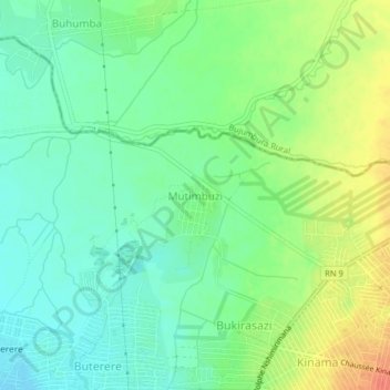
Name: Mutimbuzi topographic map, elevation, terrain.
Location: Mutimbuzi, Bujumbura Mairie, Burundi (-3.33639 29.34421 -3.29639 29.38421)
Average elevation: 2,618 ft
Minimum elevation: 2,559 ft
Maximum elevation: 2,713 ft
Other topographic maps
Click on a map to view its topography, its elevation and its terrain.
Buterere
Burundi > Bujumbura Mairie > Buterere
Buterere, Bujumbura Mairie, 331, Burundi
Average elevation: 2,589 ft