Geolocate

Pinewood topographic map

Click on the map to display elevation.

About this map

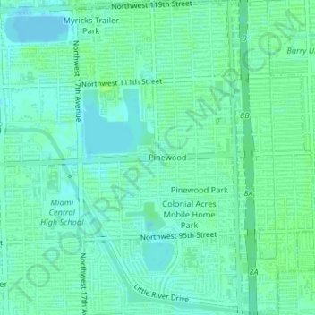
Name: Pinewood topographic map, elevation, terrain.

Location: Pinewood, Miami-Dade County, Florida, United States (25.85410 -80.22660 25.88374 -80.20798)

Average elevation: 26 ft

Minimum elevation: 10 ft

Maximum elevation: 39 ft

Miami-Dade County trails, hiking, mountain biking, running and outdoor activities

Gear up for your next adventure:

🛡️Bear Spray Outdoor - Protection in bear country hikes
🦶Hiking Gaiters - Keep debris and water out of your boots
🪑Portable Camp Table - Compact table for campsite meals
🏕️Tent Footprint - Protect your tent base from wear
🧢Outdoor Hiking Hat - Sun protection hat for outdoor explorers

As an Amazon Associate, this site earns from qualifying purchases at no extra cost to you.