
Thank you for supporting this site ❤️
Make a donation
Make a donation
Gear up for your next adventure:
As an Amazon Associate, this site earns from qualifying purchases at no extra cost to you.
Ottafe topographic map
Click on the map to display elevation.
Thank you for supporting this site ❤️
Make a donation
Make a donation
Gear up for your next adventure:
As an Amazon Associate, this site earns from qualifying purchases at no extra cost to you.
About this map
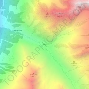
Name: Ottafe topographic map, elevation, terrain.
Location: Ottafe, Täsch, Viège, Valais, 3929, Suisse (46.03927 7.79097 46.07927 7.83097)
Average elevation: 8,379 ft
Minimum elevation: 5,039 ft
Maximum elevation: 12,221 ft
Thank you for supporting this site ❤️
Make a donation
Make a donation
Gear up for your next adventure:
As an Amazon Associate, this site earns from qualifying purchases at no extra cost to you.