
李桥镇 topographic map
Interactive map
Click on the map to display elevation.
About this map
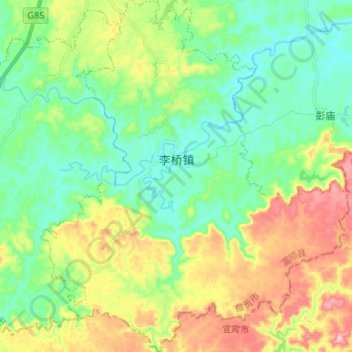
Name: 李桥镇 topographic map, elevation, terrain.
Location: 李桥镇, 富顺县, 自贡市, 四川省, 中国 (28.99244 104.76460 29.10826 104.88064)
Average elevation: 1,145 ft
Minimum elevation: 876 ft
Maximum elevation: 1,680 ft
Other topographic maps
Click on a map to view its topography, its elevation and its terrain.