
Thank you for supporting this site ❤️
Make a donation
Make a donation
Gear up for your next adventure:
As an Amazon Associate, this site earns from qualifying purchases at no extra cost to you.
Sunīši topographic map
Click on the map to display elevation.
Thank you for supporting this site ❤️
Make a donation
Make a donation
Gear up for your next adventure:
As an Amazon Associate, this site earns from qualifying purchases at no extra cost to you.
About this map
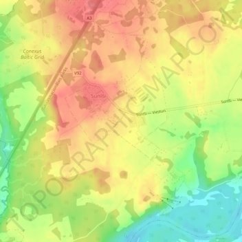
Name: Sunīši topographic map, elevation, terrain.
Location: Sunīši, Krimuldas pagasts, Siguldas novads, Vidzeme, Latvia (57.15047 24.69414 57.15923 24.71512)
Average elevation: 161 ft
Minimum elevation: 20 ft
Maximum elevation: 259 ft
Thank you for supporting this site ❤️
Make a donation
Make a donation
Gear up for your next adventure:
As an Amazon Associate, this site earns from qualifying purchases at no extra cost to you.