
Pocomo topographic map
Click on the map to display elevation.
About this map
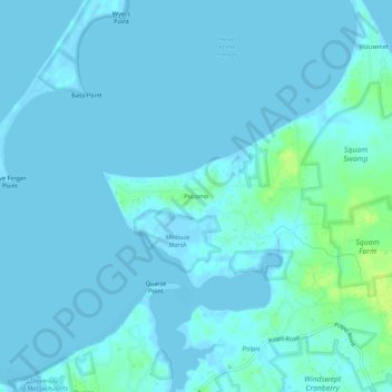
Name: Pocomo topographic map, elevation, terrain.
Location: Pocomo, Nantucket, Massachusetts, United States (41.29401 -70.04029 41.33401 -70.00029)
Average elevation: 7 ft
Minimum elevation: -13 ft
Maximum elevation: 52 ft
Massachusetts trails, hiking, mountain biking, running and outdoor activities
Other topographic maps
Click on a map to view its topography, its elevation and its terrain.