
Make a donation
Gear up for your next adventure:
As an Amazon Associate, this site earns from qualifying purchases at no extra cost to you.
Gran Chaco topographic map
Click on the map to display elevation.
Make a donation
Gear up for your next adventure:
As an Amazon Associate, this site earns from qualifying purchases at no extra cost to you.
Gran Chaco
Large tracts of the central and northern Chaco have high soil fertility, sandy alluvial soils with elevated levels of phosphorus, and a topography that is favorable for agricultural development. Other aspects are challenging for farming: a semiarid to semihumid climate (600–1300 mm annual rainfall) with a six-month dry season and sufficient fresh groundwater restricted to roughly one-third of the region, two-thirds being without groundwater or with groundwater of high salinity. Soils are generally erosion-prone once the forest has been cleared. In the central and northern Paraguay Chaco, occasional dust storms have caused major topsoil loss.
Make a donation
Gear up for your next adventure:
As an Amazon Associate, this site earns from qualifying purchases at no extra cost to you.
About this map
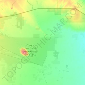
Name: Gran Chaco topographic map, elevation, terrain.
Average elevation: 545 ft
Minimum elevation: 289 ft
Maximum elevation: 2,638 ft
Make a donation
Gear up for your next adventure:
As an Amazon Associate, this site earns from qualifying purchases at no extra cost to you.