Geolocate

Altendorf topographic map

Click on the map to display elevation.

About this map

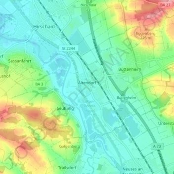
Name: Altendorf topographic map, elevation, terrain.

Location: Altendorf, Landkreis Bamberg, Bavaria, 96146, Germany (49.78132 10.96950 49.81360 11.04884)

Average elevation: 896 ft

Minimum elevation: 791 ft

Maximum elevation: 1,158 ft

Other topographic maps

Click on a map to view its topography, its elevation and its terrain.

Wind

Germany > Bavaria > Landkreis Bamberg

Average elevation: 932 ft

Gear up for your next adventure:

🏕️Family Camping Gear - Essentials for group camping trips
🧭GPS Watch Accessories - Bands and chargers for GPS watches
🎒Trekking Poles - Sturdy poles for balance and stability on rough terrain
🛠️Outdoor Gear Repair Kit - Essential tools to fix gear on the trail
🔥Fast-Boil Camping Stoves - Efficient cooking systems for quick trail meals

As an Amazon Associate, this site earns from qualifying purchases at no extra cost to you.