Geolocate

Alkol topographic map

Click on the map to display elevation.

About this map

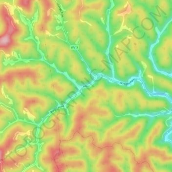
Name: Alkol topographic map, elevation, terrain.

Location: Alkol, Lincoln County, West Virginia, 25572, United States (38.14287 -81.94485 38.18287 -81.90485)

Average elevation: 997 ft

Minimum elevation: 666 ft

Maximum elevation: 1,329 ft

Lincoln County trails, hiking, mountain biking, running and outdoor activities

Gear up for your next adventure:

🔌Solar Panel Charger - Charge gear sustainably outdoors
🪶Trail Camera - Capture wildlife on your hikes
🧤Hiking Gloves - Protective gloves for rugged trails
🚪Portable Camp Chair - Foldable chair for comfort at camp
🥾Hiking Shoes - Durable and comfortable shoes for trail hiking

As an Amazon Associate, this site earns from qualifying purchases at no extra cost to you.