
Thank you for supporting this site ❤️
Make a donation
Make a donation
Gear up for your next adventure:
As an Amazon Associate, this site earns from qualifying purchases at no extra cost to you.
Pangoa topographic map
Click on the map to display elevation.
Thank you for supporting this site ❤️
Make a donation
Make a donation
Gear up for your next adventure:
As an Amazon Associate, this site earns from qualifying purchases at no extra cost to you.
About this map
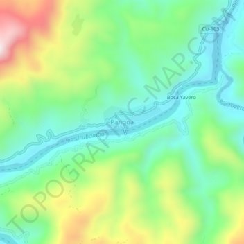
Name: Pangoa topographic map, elevation, terrain.
Location: Pangoa, Echarate, La Convención, Cusco, Perú (-12.38185 -72.90758 -12.34185 -72.86758)
Average elevation: 2,159 ft
Minimum elevation: 1,490 ft
Maximum elevation: 3,524 ft
Thank you for supporting this site ❤️
Make a donation
Make a donation
Gear up for your next adventure:
As an Amazon Associate, this site earns from qualifying purchases at no extra cost to you.