Geolocate

Marawer topographic map

Click on the map to display elevation.

About this map

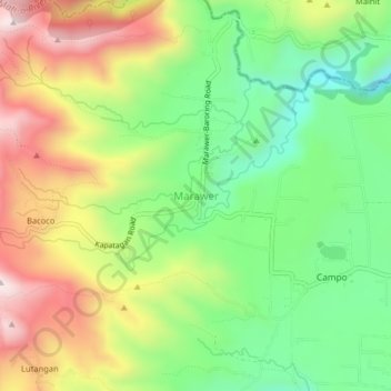
Name: Marawer topographic map, elevation, terrain.

Location: Marawer, Digos, Davao del Sur, Davao Region, 8002, Philippines (6.91831 125.29432 6.95831 125.33432)

Average elevation: 3,937 ft

Minimum elevation: 3,117 ft

Maximum elevation: 5,007 ft

Gear up for your next adventure:

👟Men's Trail Runners - Lightweight footwear for fast-paced exploration and light hiking
📡Handheld GPS Device - Reliable handheld GPS for outdoor navigation
📶Satellite Messenger - Communication device off‑grid
💧Water Filtration Bottles - Safely drink from streams and lakes while exploring
🔭Telescopic Hiking Pole - Adjustable pole for hiking stability

As an Amazon Associate, this site earns from qualifying purchases at no extra cost to you.