Geolocate

Glinde topographic map

Click on the map to display elevation.

About this map

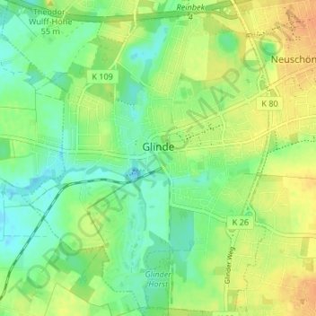
Name: Glinde topographic map, elevation, terrain.

Location: Glinde, Kreis Stormarn, Schleswig-Holstein, 21509, Germany (53.51993 10.18053 53.55941 10.23692)

Average elevation: 108 ft

Minimum elevation: 59 ft

Maximum elevation: 167 ft

Gear up for your next adventure:

🎒Trail Energy Bars - High‑calorie bars for hiking energy
🧭Compass with Lanyard - Easy‑carry compass for navigation
☀️Outdoor Sunscreen - High protection sunscreen for outdoor activities
🔊Portable Camp Speaker - Music and alerts at camp
🧤Tactile Hiking Gloves - Keep hands warm while operating GPS and smartphone screens

As an Amazon Associate, this site earns from qualifying purchases at no extra cost to you.