
Thank you for supporting this site ❤️
Make a donation
Make a donation
Gear up for your next adventure:
As an Amazon Associate, this site earns from qualifying purchases at no extra cost to you.
Eigenbilzen topographic map
Click on the map to display elevation.
Thank you for supporting this site ❤️
Make a donation
Make a donation
Gear up for your next adventure:
As an Amazon Associate, this site earns from qualifying purchases at no extra cost to you.
About this map
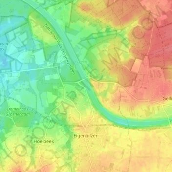
Name: Eigenbilzen topographic map, elevation, terrain.
Location: Eigenbilzen, Bilzen, Tongeren, Limburg, Flanders, Belgium (50.86499 5.55208 50.90916 5.59428)
Average elevation: 246 ft
Minimum elevation: 141 ft
Maximum elevation: 344 ft
Thank you for supporting this site ❤️
Make a donation
Make a donation
Gear up for your next adventure:
As an Amazon Associate, this site earns from qualifying purchases at no extra cost to you.