
Thank you for supporting this site ❤️
Make a donation
Make a donation
Gear up for your next adventure:
As an Amazon Associate, this site earns from qualifying purchases at no extra cost to you.
Nièvre topographic map
Click on the map to display elevation.
Thank you for supporting this site ❤️
Make a donation
Make a donation
Gear up for your next adventure:
As an Amazon Associate, this site earns from qualifying purchases at no extra cost to you.
About this map
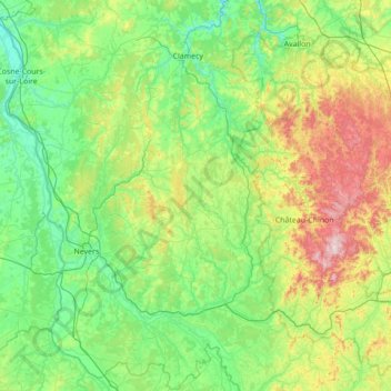
Name: Nièvre topographic map, elevation, terrain.
Location: Nièvre, Bourgogne-Franche-Comté, Metropolitan France, France (46.65102 2.84448 47.58834 4.23179)
Average elevation: 932 ft
Minimum elevation: 410 ft
Maximum elevation: 2,949 ft
Thank you for supporting this site ❤️
Make a donation
Make a donation
Gear up for your next adventure:
As an Amazon Associate, this site earns from qualifying purchases at no extra cost to you.