
Lanteiro topographic map
Interactive map
Click on the map to display elevation.
About this map
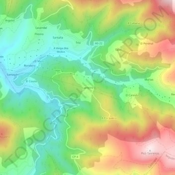
Name: Lanteiro topographic map, elevation, terrain.
Location: Lanteiro, Castropol, Asturias, 33778, España (43.43113 -7.00148 43.47113 -6.96148)
Average elevation: 866 ft
Minimum elevation: 108 ft
Maximum elevation: 1,975 ft
Other topographic maps
Click on a map to view its topography, its elevation and its terrain.